 Rubii: AI Character Community

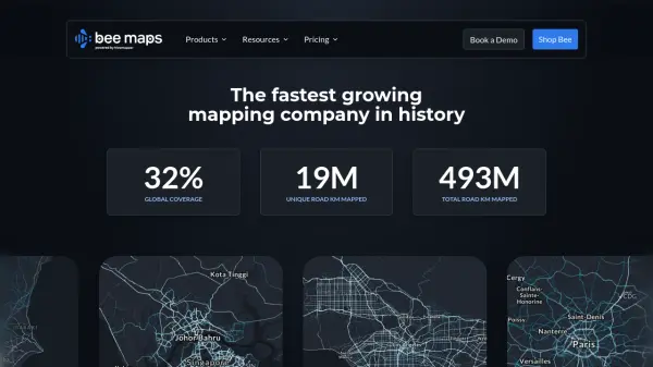
What is Bee Maps?
Bee Maps provides advanced solutions leveraging artificial intelligence for fleet management and geospatial data analysis. It offers tools designed to optimize fleet operations through AI-driven routing, cost-saving strategies, and continuous, real-time vehicle monitoring. The platform emphasizes efficiency and provides actionable insights without requiring long-term contracts or recurring subscription fees for some of its offerings.
Alongside its fleet management capabilities, Bee Maps supplies high-definition map data, refreshed significantly more frequently than traditional sources. This includes detailed street-level imagery, static map features (like parking signs, speed limits, traffic lights), dynamic features (such as roadwork, gas prices), AI-detected driver events (harsh braking, collisions), and comprehensive HD map elements, accessible via various APIs for integration into existing systems.
Features
- AI-Powered Routing: Optimizes routes for efficiency and cost savings.
- Real-Time Fleet Monitoring: Provides live visibility into vehicle location and status.
- Cost-Saving Optimizations: Identifies opportunities to reduce operational expenses.
- Hyper-Fresh Map Data: Access HD maps and features refreshed frequently.
- Map Image API: Delivers fresh, global street-level imagery.
- Map Features API: Provides access to static map features like signs, signals, and restrictions.
- Dynamic Features API: Offers real-time insights into changing road conditions like roadwork or fuel prices.
- AI-Detected Driver Events: Captures and visualizes driving events like harsh braking or collisions.
- HD Map Elements: Provides accurate road and lane insights for advanced applications.
Use Cases
- Optimizing delivery routes for logistics companies.
- Monitoring vehicle fleets for operational efficiency.
- Enhancing navigation systems with fresh map data.
- Analyzing driver behavior for insurance risk assessment.
- Supporting urban planning with up-to-date infrastructure data.
- Providing detailed location imagery for real estate analysis.
- Training autonomous vehicle models with specific driving event data.
Related Queries
Helpful for people in the following professions

Featured Tools
Join Our Newsletter
Stay updated with the latest AI tools, news, and offers by subscribing to our weekly newsletter.